 Image 1 of 3
 Image 2 of 3
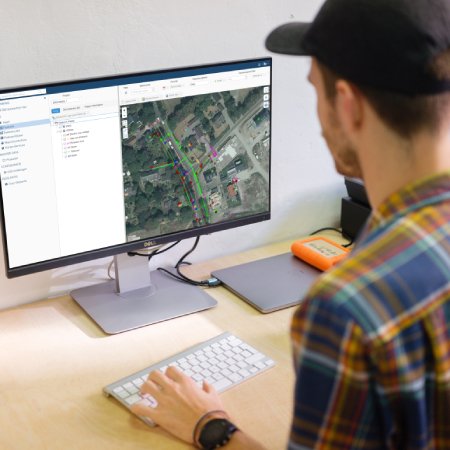 Image 3 of 3


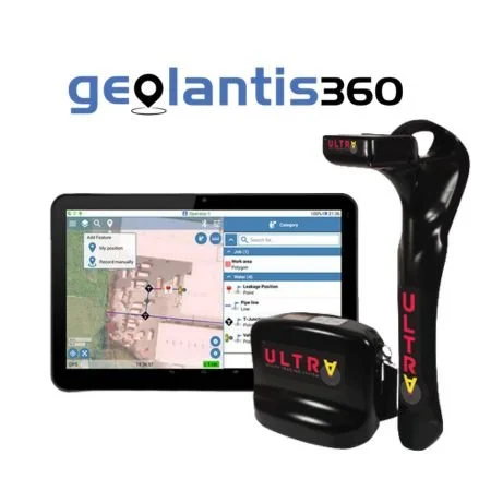
Geolantis.360TM is an innovative and cutting-edge geospatial solution that has established itself as the industry leader when it comes to capturing and precisely locating subsurface assets. This powerful software provides a comprehensive set of features and tools to effectively manage and visualize underground infrastructure.
One of the key features of Geolantis.360TM is its ability to capture precise geospatial data related to subsurface assets. Through advanced technologies such as ground-penetrating radar (GPR) and electromagnetic sensors, the software can accurately detect and map the location of underground utilities, pipelines, cables, and other infrastructure components. This allows users to have a clear understanding of the subsurface environment and avoid potential conflicts or damages during construction or excavation projects.
Geolantis.360TM also incorporates advanced data management capabilities. It enables users to store, organize, and analyse large volumes of geospatial data related to subsurface assets. The software supports various data formats, including GIS files, CAD drawings, and georeferenced imagery, ensuring compatibility with existing data sources. This allows the user to integrate their pre-existing data seamlessly into Geolantis.360TM and leverage the software's features to enhance their overall data management processes.
The software facilitates real-time collaboration among team members, allowing multiple stakeholders to access and work on the same geospatial data simultaneously. This promotes cross-functional collaboration, improves communication, and streamlines workflows. Users can share annotated maps, markups, and comments, ensuring that everyone stays updated and informed throughout the project lifecycle.
The software includes powerful geospatial analytics tools that enable users to perform spatial queries, generate reports, and extract valuable insights from the subsurface asset data. It provides statistical analysis, trend identification, and predictive modeling capabilities, empowering organizations to make data-driven decisions and optimize their asset management strategies.