
 Image 1 of 4
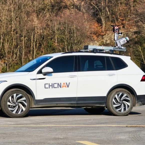 Image 2 of 4
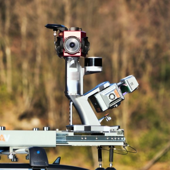 Image 3 of 4
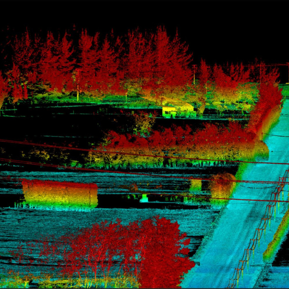 Image 4 of 4
Precise Data Capture
Powered by 4th Gen Real-time Waveform Processing (RWP) technology, the AU20 MMS captures up to 2 million points per second at 200 revolutions per second. Delivering 5 mm accuracy and 3 mm precision, it effectively captures road textures, manhole covers, and fine markings with survey-grade detail.
High-Density Point Cloud
The AU20 leverages long-range, multi-cycle LiDAR to generate point clouds with 4× greater density within a 250-meter range. This enables exceptional clarity for complex roadside structures and pavement surfaces.
Dual-Laser Scanning
The AP7 platform supports a dual-laser configuration, doubling point density and coverage. Its 45° scanning angle enables simultaneous, multi-angle data capture, reducing blind spots, enhancing road sign detection, and improving feature recognition under dynamic conditions.
Multi-Sensor Integration
The AP7’s built-in processor supports up to 8 external sensors, including pavement cameras, enabling comprehensive road damage detection. Seamless compatibility with Ladybug5+ and Ladybug6 panoramic cameras offers unmatched operational flexibility for diverse mapping scenarios.
AI-Enhanced Colorization
Using advanced AI, the AU20 delivers >95% panoramic coloring accuracy by detecting and filtering vehicles, pedestrians, and environmental noise. One-click optimization produces clean, interference-free point clouds for high-fidelity mapping.
Automated VMA Correction
Built-in AI algorithms automatically detect and correct vertical mapping alignment (VMA) errors using control points, maintaining <2 cm accuracy. This ensures compliance with highway-grade standards even in complex environments.