
How to Bench & Adjust Datum in CHCNAV TX73
Watch the video or follow the step by step guide below:
1. Set up a stable benchmark
The goal is to bench the machine: verify that the GPS coordinate at the bucket matches the site datum.
Ask your surveyor to install a benchmark:
In a solid location that will not move
Where the machine can easily reach it
Make sure the benchmark is protected and accessible for the machine to touch accurately.
2. Position the bucket on the benchmark
Carefully move the machine close to the benchmark.
Place the tip/corner of the bucket directly on top of the benchmark.
Be careful not to disturb the survey mark while doing this.
3. Open the bucket coordinate screen
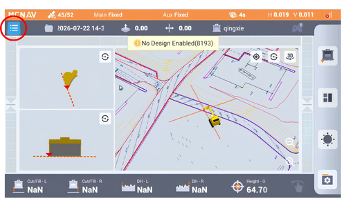
On the machine, go to: Main menu > Config > Bucket coordinates
This screen shows the GPS coordinate being read at the tip of the bucket.
Expect the numbers to bounce slightly as GPS corrections update; that is normal.
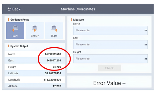
4. Enter the benchmark coordinates from the surveyor
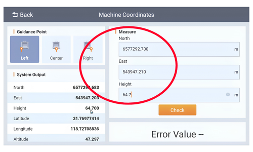
Ask the surveyor for the benchmark’s known coordinates.
Type the benchmark values directly into the coordinate fields:
North
East
Height
5. Compare the machine reading to the benchmark.
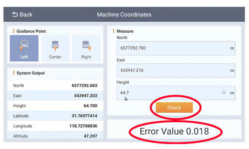
Press Check to compare the machine’s bucket position against the benchmark.
The system will show the difference between the two sets of coordinates.
A small difference may be acceptable, depending on your tolerance. In the example, the difference is 18 mm.
6. Adjust antenna offset if the height is off.
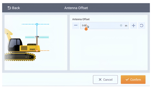
If the bucket height/RL is not matching the benchmark, adjust the antenna offset.
Example:
Benchmark RL = 64.65
Machine reading = 64.70
Difference = 50 mm
Go back to:
Config
Antenna offset
Enter the required adjustment and confirm it.
7. Recheck the bucket coordinates.
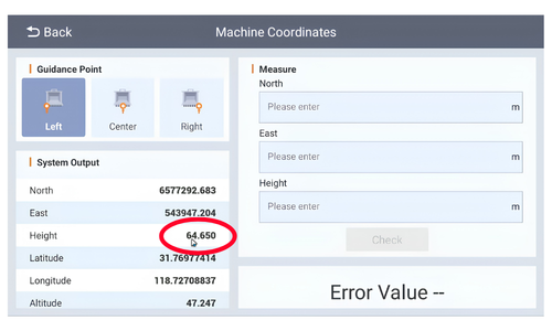
Return to Bucket coordinates and verify the updated reading.
The RL should now match the surveyor’s benchmark value.
This confirms the antenna has been calibrated correctly for height.
8. Load a site calibration if northing/easting are still wrong.
If the northing and easting do not match the benchmark coordinates, the issue is not just antenna height.
In that case, you likely need a site calibration file from the surveyor.
Load the calibration file to correct the horizontal position as well as the vertical one.